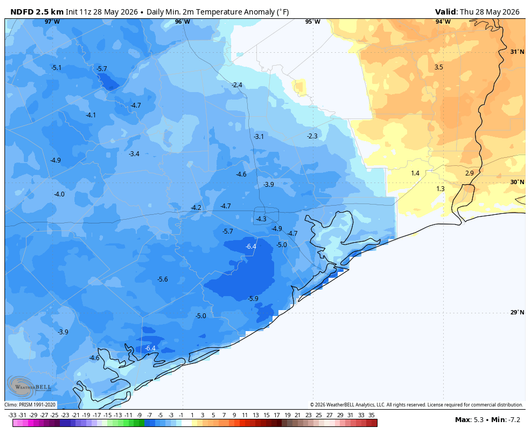
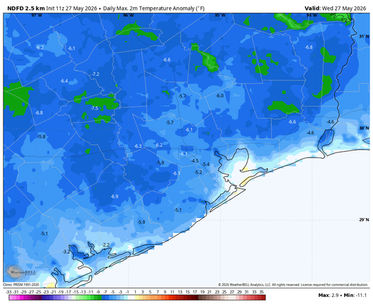
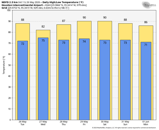
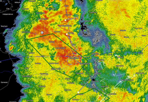
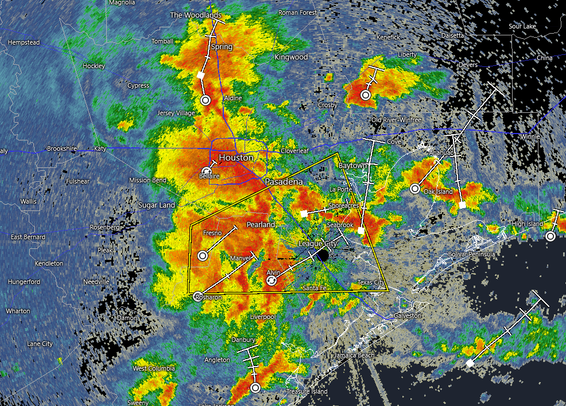
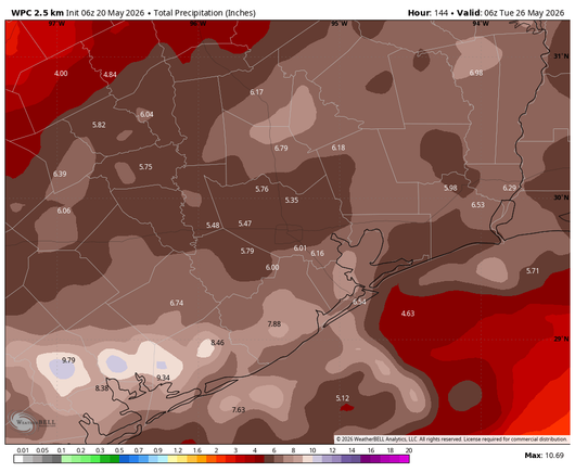
A quiet weekend looks to be in store for Houston with standard early summer hot weather and minimal rain chances. Things turn more active again next week with building rain chances after Tuesday.
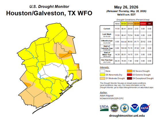
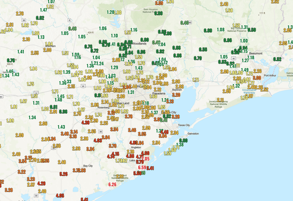
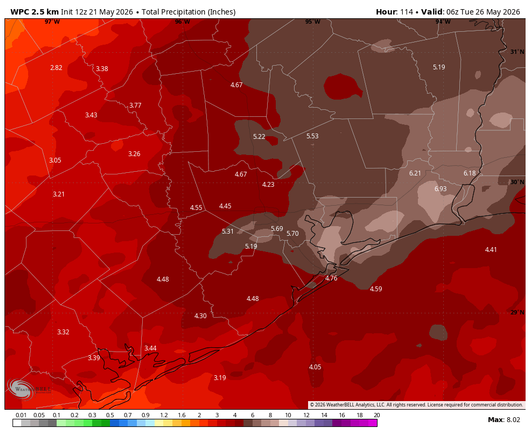
After recent rains, most of the Houston area is officially out of drought for the first time since September
In brief: A quiet weekend looks to be in store for Houston with standard early summer hot weather and minimal rain chances. Things do turn more active again next week with building rain chances aft…