#PleiadesGazetteer sneak peek!

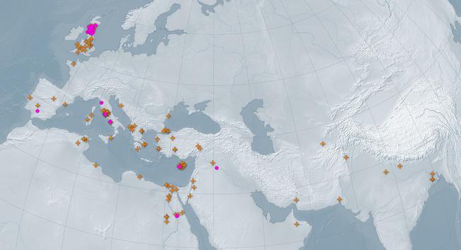
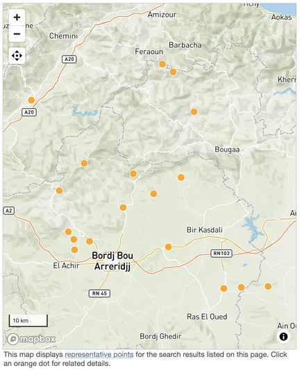
We'll release our usual "Last Week" summary blog post on Monday, but meantime here's the first fruits of what's likely to be a long, slow project: completing and refining Barrington Atlas coverage in North Africa. In the last few days, @serviliusahala has reviewed and published new and updated records I prepared for 18 places in modern Algeria, mostly north and east of modern Bordj Bou Arreridjj: https://pleiades.stoa.org/search?Cites=%22BAtlas+31+%22&created%3Alist%3Adate=2025%2F05%2F23&created_usage=range%3Amin&portal_type%3Alist=Place&review_state%3Alist=published

Many of these are unexcavated and/or heavily spoliated sites that were cataloged by Stéphane Gsell in the *Atlas Archéologique de l’Algérie* (Algiers, Paris: 1911) with only then-modern or no associated toponymy. They were subsequently added to the relevant Barrington Atlas maps without labels or individual directory entries... 1/?
#ancientGeography #ancientHistory #archaeology #HGIS

Pleiades Datasets 4.1 has been released.

Get the official distribution: https://doi.org/10.5281/zenodo.15540082

Version 4.1 - 28 May 2025: 41,480 place resources

Since release 4.0.1 of pleiades.datasets on 6 February 2025, the Pleiades gazetteer published 287 new and 2,757 updated place resources, reflecting the work of Jeffrey Becker, Sarah Bond, Catherine Bouras, Anne Chen, Birgit Christiansen, Matthew Clark, Stefano Costa, Anthony Durham, Tom Elliott, Margherita Fantoli, E.W.B. Fentress, Güner Girgin, Maxime Guénette, Greta Hawes, Brady Kiesling, Chris de Lisle, Sean Manning, Gabriel McKee, John Muccigrosso, Jamie Novotny, Gethin Rees, Rosemary Selth, R. Scott Smith, Nicolas Souchon, Néhémie Strupler, Richard Talbert, Clifflena Tiah, and Scott Vanderbilt. As a result, this release provides documentation for 41,480 place resources.

#ancientGeography #ancientHistory #archaeology #DH #gazetteers #HGIS
Pleiades Datasets 4.1

Pleiades gazetteer datasets Please report problems and make feature requests via the main Pleiades Gazetteer Issue Tracker. Content is governed by the copyrights of the individual contributors responsible for its creation. Some rights are reserved. All content is distributed under the terms of a Creative Commons Attribution license (cc-by). In order to facilitate reproducibility and to comply with license terms, we encourage use and citation of numbered releases for scholarly work that will be published in static form. Please share notices of data reuse with the Pleiades community via email to pleiades.admin@nyu.edu. These reports help us to justify continued funding and operation of the gazetteer and to prioritize updates and improvements. Version 4.1 - 28 May 2025 41,480 place resources Since release 4.0.1 of pleiades.datasets on 6 February 2025, the Pleiades gazetteer published 287 new and 2,757 updated place resources, reflecting the work of Jeffrey Becker, Sarah Bond, Catherine Bouras, Anne Chen, Birgit Christiansen, Matthew Clark, Stefano Costa, Anthony Durham, Tom Elliott, Margherita Fantoli, E.W.B. Fentress, Güner Girgin, Maxime Guénette, Greta Hawes, Brady Kiesling, Chris de Lisle, Sean Manning, Gabriel McKee, John Muccigrosso, Jamie Novotny, Gethin Rees, Rosemary Selth, R. Scott Smith, Nicolas Souchon, Néhémie Strupler, Richard Talbert, Clifflena Tiah, and Scott Vanderbilt. As a result, this release provides documentation for 41,480 place resources. Highlights Updated gazetteer data in this release: see "Contents" below. Updated data/gis/README.md for new places_accuracy.csv file, which provides more horizontal accuracy data for use in GIS software. Updated information about Pleiades Sidebar (q.v.) Overview This is a package of data derived from the Pleiades gazetteer of ancient places. It is used for archival and redistribution purposes and is likely to be less up-to-date than the live data at https://pleiades.stoa.org. Pleiades is a community-built gazetteer and graph of ancient places. It publishes authoritative information about ancient places and spaces, providing unique services for finding, displaying, and reusing that information under open license. It publishes not just for individual human users, but also for search engines and for the widening array of computational research and visualization tools that support humanities teaching and research. Pleiades is a continuously published scholarly reference work for the 21st century. We embrace the new paradigm of citizen humanities, encouraging contributions from any knowledgeable person and doing so in a context of pervasive peer review. Pleiades welcomes your contribution, no matter how small, and we have a number of useful tasks suitable for volunteers of every interest. Access and Archiving The latest versions of this package can be had by fork or download from the main branch at https://github.com/isawnyu/pleiades-datasets. Numbered releases are created periodically at GitHub. These are archived at: zenodo.org using the DOI 10.5281/zenodo.1193921 archive.nyu.edu using the Handle 2451/34305 archive.org using the URI https://archive.org/details/pleiades.datasets-{version_number} Credits Pleiades is brought to you by: Our volunteer content contributors (see data/rdf/authors.ttl for complete list and associated identifiers or data). Pleiades received significant, periodic support from the National Endowment for the Humanities between 2006 and 2019. Grant numbers: HK-230973-15, PA-51873-06, PX-50003-08, and PW-50557-10. Any views, findings, conclusions, or recommendations expressed in this publication do not necessarily reflect those of the National Endowment for the Humanities. Web hosting and additional support has been provided since 2008 by the Institute for the Study of the Ancient World at New York University. Additional support and in-kind collaboration has been provided since 2000 by the Ancient World Mapping Center at the University of North Carolina at Chapel Hill. Development hosting and other project incubation support was provided between 2000 and 2008 by Ross Scaife and the Stoa Consortium.

Zenodo

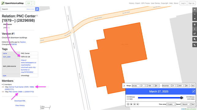
@ShionAmasato Love this example of finding information on old buildings and using OpenHistoricalMap as a place to store that data!

#DigitalHumanities #HGIS

#Frühling im botanischen Garten #Frankfurt. Auch ein Frühling für die historische Kartografie der frühen Neuzeit? Im Anschluss an das @DigiKAR Projekt treffen wir uns an der Goethe-Universität u.a. mit der Kartographie Expertin des @Leibniz_IfL ich freue mich, meinen Impulsvortrag aus hessischer Sicht zu halten und vor allem auf den Austausch und die Diskussionen #hgis #HisGIS

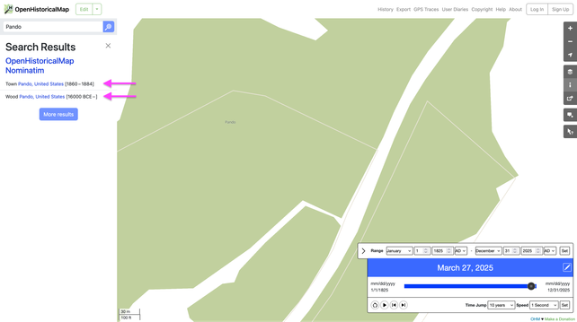
Start and end #dates are very important for a #HistoricalGIS project. We managed to stuff dates into more of the website’s nooks and crannies, so you always know which stage of a boundary or building’s evolution you’re looking at, or whether it’s even the one you’re looking for.

#HGIS

Last Week in Pleiades (24 February - 3 March 2025)

Last week the Pleiades editorial college published 44 new and 136 updated place resources, reflecting the work of Jeffrey Becker, Anne Chen, Matthew Clark, Tom Elliott, Maxime Guénette, Brady Kiesling, Nicolas Souchon and Néhémie Strupler.

A complete list of additions and changes, include general descriptions of places, change summaries, credit lines, and links to the actual gazetteer entries may be read on the blog at https://pleiades.stoa.org/news/blog/last-week-in-pleiades-24-february-3-march-2025

#ancientGeography #ancientHistory #archaeology #gazetteers #HGIS #LAWDI #LOD
Last Week in Pleiades (24 February - 3 March 2025)

Last week the Pleiades editorial college published 44 new and 136 updated place resources, reflecting the work of Jeffrey Becker, Anne Chen, Matthew Clark, Tom Elliott, Maxime Guénette, Brady Kiesling, Nicolas Souchon and Néhémie Strupler.

Pleiades: a gazetteer of past places
Updated Pleiades "GIS package" (CSV) export derivative for 2025-03-03:

Five new connections; 12 retracted, 7 modified, and 33 new locations; 13 modified and 13 new names; 37 modified and 19 new places.

Corresponding data: https://github.com/isawnyu/pleiades.datasets/commit/0d9205d388fa0610891c0955ad121ce171b62416#diff-1f7dc714879d86568011fc3d0faaa92cfd4400757d660174821aace9fa45f7fc

#HGIS
updated gis package · isawnyu/pleiades.datasets@0d9205d

Platform-independent versions of Pleiades gazetteer data - updated gis package · isawnyu/pleiades.datasets@0d9205d

GitHub
Updated Pleiades "GIS Package" (CSV) export derivative:

4 new and 18 updated features.

Corresponding data: https://github.com/isawnyu/pleiades.datasets/commit/c4895c3b9f13d1a75691788126a2f57cebb7177c

#HGIS
updated gis package · isawnyu/pleiades.datasets@c4895c3

Platform-independent versions of Pleiades gazetteer data - updated gis package · isawnyu/pleiades.datasets@c4895c3

GitHub

#qgis resources repository with 28 icon collections, more than 3k icons. Special focus on #hgis All icons released as CC0/PD.
Hope this might be useful and will update my original collection when possible ;)

https://github.com/projetoalfobre/alfobre-qgis-resources

GitHub - projetoalfobre/alfobre-qgis-resources

Contribute to projetoalfobre/alfobre-qgis-resources development by creating an account on GitHub.

GitHub

Congratulations Josh Rhodes @joshrhodes.bsky.social on releasing...

- Map census variables at street level with:
AddressGB: Geo-coded British Census Addresses, 1851-1911 https://doi.org/10.5281/zenodo.10473597

- Evaluate the results (or your own!) with
AddressGB Manual Evaluation Sample https://doi.org/10.5281/zenodo.13770048

#OpenAccess
#DigitalHumanities
#EconHist
#hgis

AddressGB: Geo-coded British Census Addresses, 1851-1911

Links c. 121 million individuals from historic British census data for 1851 to 1911 (I-CeM) to modern road data (OS Open Roads) and historic street/placenames (GB1900). Enables researchers to map historic British census data at street and property level. This provides a much higher spatial resolution than existing approaches that aggregate individuals to parishes or census registration sub-districts. For full documentation see the README. For the method, see CensusGeocoder.  For each census year (e.g. England & Wales, 1851), it contains the following files: GIS Data a modified version of GB1900, with GB1900 points assigned to historic administrative boundaries (gb1900.tsv) a modified version of OS Open Roads, with roads segmented by relevant historic administrative boundaries (osopenroads.tsv) Lookup Data a lookup file linking individuals in I-CeM to the modified version of GB1900 (gb1900_recidlkup.tsv) a lookup file linking individuals in I-CeM to the modified version of OS Open Roads (osopenroads_recidlkup.tsv) Metadata A metadata file for each file type, specifying field type and number of records. Licence / Other Info AddressGB contains modified data from GB1900. It acknowledges the Great Britain Historical GIS, the GB1900 partners and volunteers, and makes the data available on the same Creative Commons Attribution Share Alike Licence as per the GB1900 project site. AddressGB contains no named individuals and no addresses from I-CeM. It only contains the unique person identifiers (RecID) to link entries to I-CeM. For more information on I-CeM, see https://www.campop.geog.cam.ac.uk/research/projects/icem/.

Zenodo