#ABR #SDwx 584
CDUS43 KABR 172224
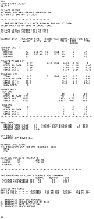
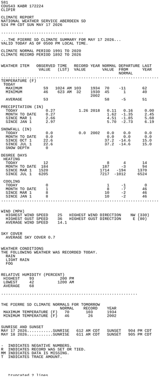
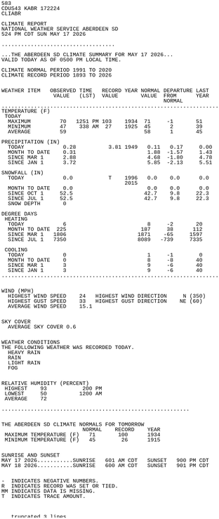
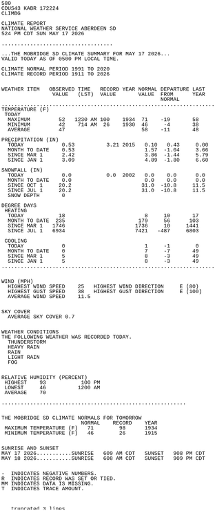
CLIATY
CLIMATE REPORT
NATIONAL WEATHER SERVICE ABERDEEN SD
524 PM CDT SUN MAY 17 2026
...................................
...THE WATERTOWN SD CLIMATE SUMMARY FOR MAY 17 2026...
VALID TODAY AS OF 0500 PM LOCAL TIME.
CLIMATE NORMAL PERIOD 1991 TO 2020
CLIMATE RECORD PERIOD 1898 TO 2026
WEATHER ITEM OBSERVED TIME RECORD YEAR NORMAL DEPARTURE LAST
VALUE (LST) VALUE VALUE FROM YEAR
https://mesonet.agron.iastate.edu/p.php?pid=202605172224-KABR-CDUS43-CLIATY