At right in that image is a larger area of the surface showing the surface eroded by the landing thrusters. Mosaics like this are much easier to make today with modern image processing software than in the Viking period when they were constructed from printed images. This image shows the approximate location relative to the surface imaged directly by the cameras.
#mars #viking2
If you look back to Viking 1:
https://mastodon.social/@PhilStooke/115376798213914717
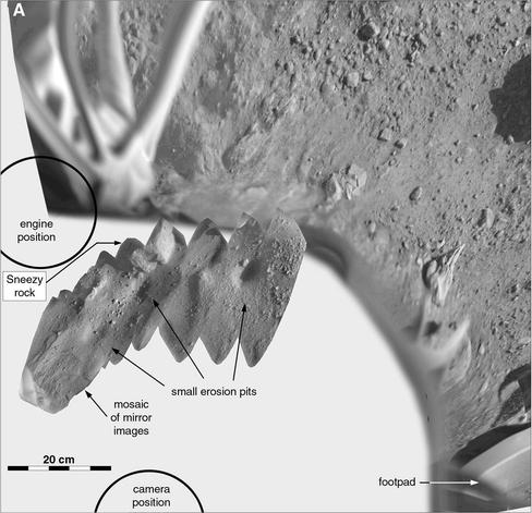
you will see a bit about the mirrors mounted on the arm housing on each Viking lander. The mirrors reflected an image of the surface just under the lander. By moving the arm slightly the reflected area could be changed and a mosaic could be constructed. Here are two mosaics for Viking 2, one from each mirror. At left a bit of the lander near the front left footpad shows a temperature sensor.
#mars #viking2
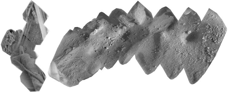
And the same content in panorama geometry, as before.
There is not much more to say about Viking 2 but I do have one last treat for tomorrow.
#mars #viking2
After that the arm was parked and not used again. This map shows the sample area at the end of the mission.
#mars #maps #viking2
#mars #maps #viking2

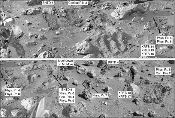
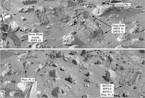
Continuing from yesterday's post, those physical properties activities did various things. I don't know the purpose of Phys. prop 4, but it dug up fine-grained material and one buried rock. PP 6 at the bottom was supposed to measure surface strength but the result was lost somehow, not downlinked. PP 8 dug soil which was used to make Conical Pile 4. PP 9 was a surface strength test again and the scoop with its temperature sensor was left in the soil for a full day.
#mars #viking2
#mars #viking2
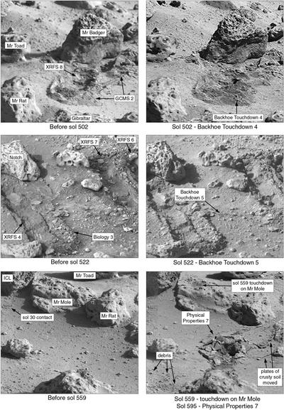
The sol 522 touchdown was done to... actually I don't know why it was done. The sol 559 touchdown was an attempt to chip Mr Mole - but it didn't, indicating that it was fairly hard. Nearby on sol 595 was a Physical Properties touchdown - the scoop was pressed down to test the bearing strength of the surface. Look at the result - the surface is not dusty but breaks up into platy chunks, probably cemented by salts left by evaporating water. They called it duricrust at the time.
#mars #viking2
#mars #viking2
We are coming to the end of Viking 2 activities with the arm. This set of before and after image pairs shows rather small events. First, on sol 502, a backhoe touchdown. The backhoe was a plate protruding under the scoop, which could be pulled through the soil to dig a trench like Deep Hole. It had a magnet on it which was imaged now and then to look for magnetic particles stuck to the magnet. This touchdown was one of those attempts to pick up particles.
#mars #viking2
#mars #viking2
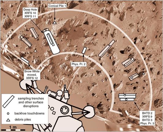
This map shows the Viking 2 sample field after 500 sols. Digs at the near end of Deep Hole which we have already seen happened after sol 500 so they are not shown. I quite like being able to see the sampling area evolving like this.
#mars #maps #viking2
#mars #maps #viking2
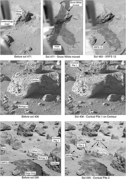
Here are some more activities at the Viking 2 site on Mars. At top, we see the arm moving a rock called Snow White, scraping the surface in the process. Then a sample is taken from the scuffed area for analysis. Next we see a conical pile of soil formed on top of a rock (this was dug out of the Phys Prop 2 trench from the previous post). Finally a 3rd conical pile was made near that same rock. We saw more of these at Viking 1.
#mars #viking2
#mars #viking2