#NMwx #graphicast A Fire Weather Watch is in effect for Thursday for a majority of eastern NM. Do your part to limit the chances of new fire starts. #OneLessSpark


The combination of the winds and low humidity will lead to conditions over much of central/southern AZ capable of causing extreme fire behavior. A cigarette tossed out the window or sparks from a dragging tow chain are just two ways a fire can start. #azwx #onelessspark https://t.co/oduP9BcUZc
Feb 28, 09:09pm -0700
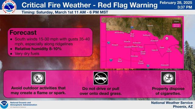

The combination of the winds and low humidity will lead to conditions over much of central/southern AZ capable of causing extreme fire behavior. A cigarette tossed out the window or sparks from a dragging tow chain are just two ways a fire can start. #azwx #onelessspark
