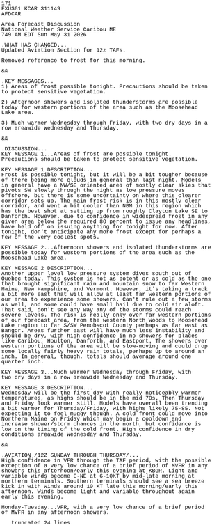
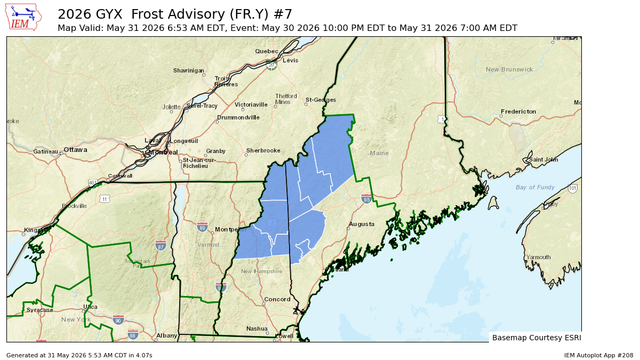
#CAR #MEwx 709
NOUS41 KCAR 311228
PNSCAR
MEZ001>006-010-011-015>017-029>032-010028-
Public Information Statement
National Weather Service Caribou ME
828 AM EDT Sun May 31 2026
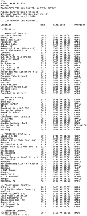
...LOW TEMPERATURE REPORTS...
Location Temp Time/Date Provider
...Maine...
...Aroostook County...
Estcourt Station 29 F 0307 AM 05/31 HADS
Oxbow, ME 29 F 0530 AM 05/31 HADS https://mesonet.agron.iastate.edu/p.php?pid=202605311228-KCAR-NOUS41-PNSCAR