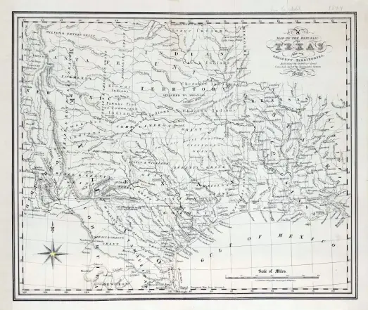
In 1841, British cartographer Charles Frederick Cheffins mapped the Republic of Texas and its neighbors — and deliberately documented the old Mexican empresario land grants still carved across the territory. Texas had been independent for five years, yet the map's memory was colonial. Those grant boundaries shaped who owned what, and who contested it. #TexasHistory #RepublicOfTexas #Cartography #LandGrants

Genealogy à la carte: Provincial Archives of New Brunswick releases digitized Crown land grant records collection. “The New Brunswick Land Grants web section contains information on more than 55,000 individuals and corporate bodies who acquired Crown land between 1784 and 2007. The quality of even the oldest documents is very good, and they are easy to download.”

https://rbfirehose.com/2025/09/28/genealogy-a-la-carte-provincial-archives-of-new-brunswick-releases-digitized-crown-land-grant-records-collection/

Genealogy à la carte: Provincial Archives of New Brunswick releases digitized Crown land grant records collection | ResearchBuzz: Firehose

ResearchBuzz: Firehose | Individual posts from ResearchBuzz
"Articles VIII and IX ensured the safety of existing property rights of #MexicanCitizens living in the transferred territories. Despite assurances to the contrary, #LandGrants by the Mexican government to its citizens were often not honored by the United States"