#BOU #COwx 611
WGUS85 KBOU 040126
FLSBOU
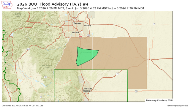
Flood Advisory
National Weather Service Denver CO
726 PM MDT Wed Jun 3 2026
COC035-039-040136-
/O.EXP.KBOU.FA.Y.0004.000000T0000Z-260604T0130Z/
/00000.N.ER.000000T0000Z.000000T0000Z.000000T0000Z.OO/
Douglas CO-Elbert CO-
726 PM MDT Wed Jun 3 2026
...FLOOD ADVISORY WILL EXPIRE AT 730 PM MDT THIS EVENING...
The Flood Advisory will expire at 730 PM MDT this evening for
portions of east central and northeast Colorado, including https://mesonet.agron.iastate.edu/vtec/f/2026-O-EXP-KBOU-FA-Y-0004_2026-06-04T01:26Z