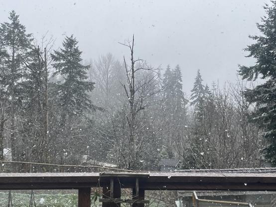
Mix of snow and rain begins on the Island. Atmospheric River event incoming. Look for ECCC to post various warnings today into tomorrow and through to Wednesday.
#bcstorm #bcsnow #portalberni #vancouverisland #atmosphericriver
Important: Special Weather Statement advising of a potentially serious spring-melt inducing Atmospheric River. West Vancover Island could see 300mm, Inland 150mm. Rivers could be dangerous due to snow melt.
The event will begin with potential snow Sunday shifting to heavy rain Monday through Wednesday.
https://weather.gc.ca/warnings/report_e.html?bc45=
#portalberni #bcstorm #bcsnow #atmosphericRiver #rain
When severe weather threatens, Environment Canada issues alerts that notify those in affected areas in British Columbia so that they can take steps to protect themselves and their property from harm. The type of alert issued depends on the severity and timing of the event. Special statements: issued to highlight significant weather or express uncertainty. Watches: alert you about weather conditions that are favourable for a storm or severe weather, which could cause safety concerns. Warning: an urgent message that severe weather is either occurring or will occur. Warnings are usually issued six to 24 hours in advance, although some severe weather (such as thunderstorms and tornadoes) can occur rapidly, with less than a half hours' notice.
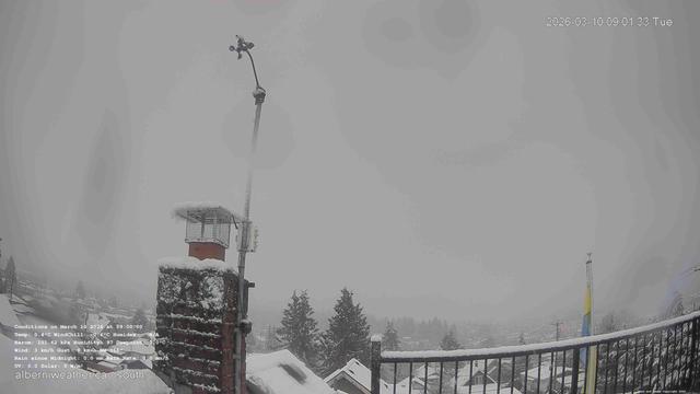
woops! better late than never on the snowfall warning!
latest link is always on https://alberniweather.ca
"Impact Level: Moderate
Forecast Confidence: High
Snowfall with total amounts of 10 to 20 cm is expected.
When: Today.
Where: Inland Vancouver Island.
What:
- 10 to 15 cm of snow for communities in valley bottoms.
- 10 to 20 cm for high-elevation roads.”

Alberniweather Podcasts Webcams Satellites and Radar BC Wildfire Map Air Quality Condolences for Evan – The Hammer – Hammond – A Professional January 5, 2026 Changes in the weather and website October 11, 2024 July 29, 2024 July 29, 2024 July 29, 2024 Port Alberni nuučaan̓uł ḥaḥuułi Marine West Coast East Coast ...
Official 9:30AM measurement at Alberniweather HQ: 5.5cm!
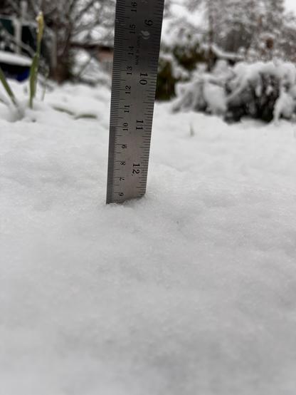
still snowing! About 5cm on the ground at Alberniweather! First real snowfall of the year... and it's March 10th, 11 days from the equinox!
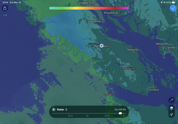
Snowfall Warning issued for southern Vancouver Island! weeeee!
Inland warning is for the Malahat Highway and Cowichan area:
https://weather.gc.ca/warnings/report_highway_e.html?mesoCode=bcrm4382
#BCSnow #BCStorm #Weather #Victoria
When severe weather threatens, Environment Canada issues alerts that notify those in affected areas in British Columbia so that they can take steps to protect themselves and their property from harm. The type of alert issued depends on the severity and timing of the event. Special statements: issued to highlight significant weather or express uncertainty. Watches: alert you about weather conditions that are favourable for a storm or severe weather, which could cause safety concerns. Warning: an urgent message that severe weather is either occurring or will occur. Warnings are usually issued six to 24 hours in advance, although some severe weather (such as thunderstorms and tornadoes) can occur rapidly, with less than a half hours' notice.