Eftychia Koukouraki

@eftyk
297 Followers
248 Following
39 Posts
Geospatial researcher interested in open data and source and in reproducible science.
PronounsShe/her
Bluesky (bridged)http://bsky.app/profile/eftyk.mastodon.social.ap.brid.gy

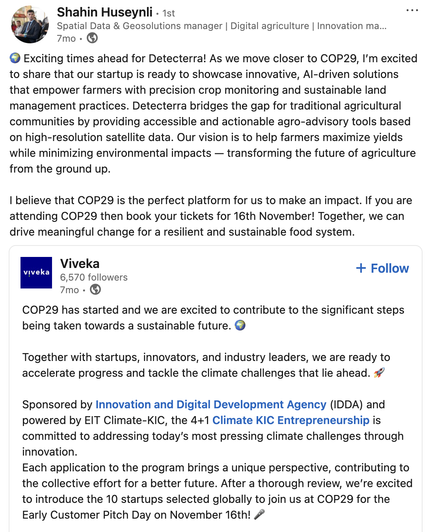
Last week, the 1st GeoAI conference took place at #UGent! I had the opportunity to attend interesting talks, engage in discussions about the future of the domain, host a workshop about the #DarkSideOfGeoAI, and, last but not least, present our work on #VISQAM, funded by #NFDI4Earth and made 100% in-house at IFGI, Uni Münster.

Check out our proceedings paper about VISQAM, an open dataset that comprises 1200 thematic geographic maps annotated with 4500+ QA pairs: https://doi.org/10.5281/zenodo.20273244.

Introducing the VISQAM Dataset: Toward Automated Map Interpretation

We introduce VISQAM, an open dataset designed specifically for visual question-answering (VQA) on thematic geographic maps. Comprising 1200 annotated images and 4594 QA pairs from four permissive-license sources, VISQAM enables the development of models capable of interpreting and understanding the complex spatial and thematic information encoded in maps. We fine-tuned Qwen3-VL-2B-Instruct on this dataset, achieving substantial performance improvements: BERTScore-F1 increased from 0.43 (base model) to 0.72 (fine-tuned), with exact match rising from 0.0 to 0.24. Our experiments highlight the challenges of spatial and relational reasoning in map interpretation. The fine-tuned model performs best on object-related questions, while relation questions prove most difficult, indicating the need for more examples of this question type in future expansions of the dataset. As automated map interpretation can improve access to spatial information, e.g. for visually impaired users, and facilitate knowledge extraction from cartographic products, VISQAM lays the groundwork for developing more advanced VQA systems.

Zenodo

RE: https://mastodon.social/@eftyk/116114766746956007

We extended the deadline for submitting statement of interest to March 22. If you're considering it, there is still time to apply 🙂

#openpeerreview cheatsheet: There are lots of ways to open up peer review (e.g.,via publish-review-curate) but since I often hear people discuss open peer review, here is a quick reminder of different dimensions of what this refer to: publication, anonymity, or inclusivity

🕶️ The Dark Side of #GeoAI – Workshop @ GeoAI 2026 🌍

Join us in mapping the risks, biases & dangers lurking in AI usage in the Geosciences — from hallucinations & bias to misinformation & ecological impacts — and developing countermeasures together.

📍 In beautiful #Ghent, Belgium 🇧🇪
📅 June 3, 2026 (afternoon)

✨ Open to ALL career stages & disciplines, not just geoscientists

📝 Submit by March 13:
A short statement of interest to [email protected]

Details: https://www.uni-muenster.de/Geoinformatics/en/sitcom/darkside.html

The Dark Side of GeoAI

🎬 GeoMundus 2025 Highlights 🎉

What a beautiful recap capturing the spirit of #GeoMundus2025 💙

GeoMundus has always been about students organizing for students, connecting bright minds from around the world. 🌍✨

As we wrap up this year’s edition in Lisbon, we’re looking ahead to the 18th GeoMundus Conference in Castellón, Spain. See you there in 2026! 🎓

🔗 https://www.linkedin.com/company/geomundusconference/

#GeoMundus #GeoMundus2025 #GeospatialTechnologies #Conference #Innovation #Community #ErasmusMundus #GIS

🧰 Practical GIS Tools

Have you tried the openEO Platform? 🛰️

It’s an open, cloud-based platform that connects you to massive Earth observation datasets and powerful processing tools — all through a unified API. 🌍💻

Whether you’re coding in Python, R, or JavaScript, openEO makes it easier to access, analyze, and visualize satellite data without downloading terabytes to your computer.

🔗 Explore now: https://openeo.cloud/

#GIStools #openEO #RemoteSensing #GIS #Tech #technology

The proceedings of GIScience 2025 🌏 are now available open access from Dagstuhl Publishing: dagstuhl.de/dagpub/978-3-95977-378-2 This volume showcases GIScience research on urban data, semantic place enrichment, knowledge graphs, mobility, geovisualization, spatial analysis, and other applications.
13th International Conference on Geographic Information Science (GIScience 2025)

*We are creating an academic journal and *you* can shape it!*

Make comments and suggest changes to replicationresearch.org 's
- Constitution
- TOP guidelines
- article types
- and reviewer guidelines
until September 5 and be credited as a contributor: https://docs.google.com/document/d/1QvxkJuUwgSzAwMjjiVeiNQ7TkCDWhEQ6Y9xhzzJygBI/edit?usp=sharing

🎓 GeoTech Alumni Sharing

Proud of Shahin Huseynli, a graduate of the GeoTech Master’s Program, who continues to make waves in the world of climate tech! 🌍

Shahin is a Manager at Detecterra, one of just 10 global startups selected to pitch at COP29’s Early Customer Pitch Day in 2024! 🚀

📌 Learn more about their work: https://detecterra.az/

#GeoTechAlumni #COP29 #ClimateTech #PrecisionAgriculture #RemoteSensing #GeospatialInnovation #Detecterra #GISForGood #Alumni #GIS #Startups

Replication Research (R2) will be open for submissions from 10-10-2025!
>> Try to reproduce or replicate your favourite findings.
>> Write up your reproduction and replication studies.
>> Share your conceptual expertise or experiences on repetitive research.

https://replicationresearch.org is a researcher-led diamond open access hosted by the Münster Center for Open Science and @FORRT. We have been creating it with a high degree of community involvement. If you want to contribute, join FORRT (https://forrt.org/about/get-involved/) or apply to be a reviewer, reproducibility checker, copy editor, associate editor, ...: https://docs.google.com/forms/d/e/1FAIpQLSc67JYOvTMLjnyDBVcxwxcQrgxH8mjvDB7QW7y9nDoTA6kp6Q/viewform?usp=dialog

Replication Research

Replication Research is a diamond open-access and researcher-led journal that publishes reproductions, replications, and conceptual articles on repetitive research