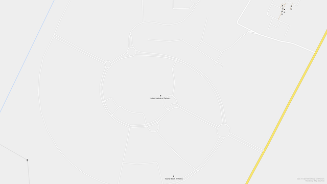
Before and after images of the #IITPatna campus on #OpenStreetMap. The data was added by @ravi @contrapunctus and @rahulporuri during the #BiharFOSS conference by
@fossunited
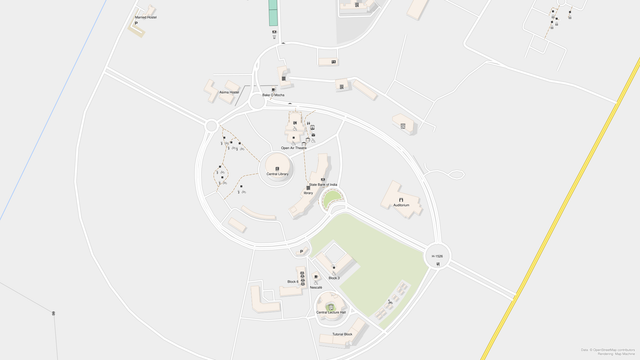
Before and after images of the #IITPatna campus on #OpenStreetMap. The data was added by @ravi @contrapunctus and @rahulporuri during the #BiharFOSS conference by
@fossunited
@contrapunctus @gedankenstuecke
Oooh. Osmarender reborn :)
Now it just needs a built-in way to download from Overpass at a specific timestamp...
@sincereabsurdity @OSMIndia @ravi @rahulporuri @fossunited Thanks! The buildings were added the usual way - we traced them from satellite imagery.
Give it a try yourself! Visit the OSM website, click Edit, and follow the walkthrough 😀
