Adventurers And Hikers Can Now Download The New #USGS [USA & territories] Topographic Maps For FREE
--
[topoBuilder, USGS #topomaps #ondemand with the latest map data]
--
https://www.earth.com/news/recreational-usgs-topographic-maps-available-build-and-download-for-free/ <-- shared 3rd party technical overview article
--
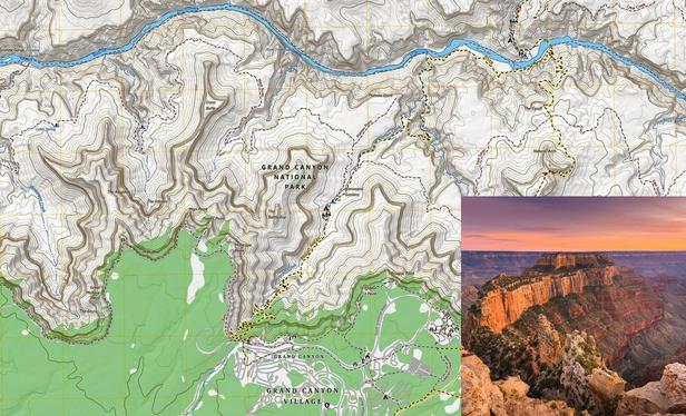
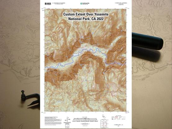
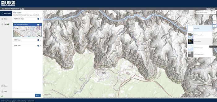
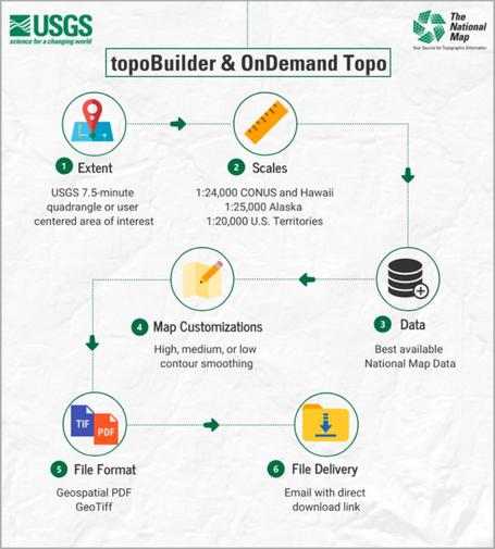
https://topobuilder.nationalmap.gov/ <-- shared link to new @USGS 25K Recreational Topo series creation / requests, and others like 250K, via #USGS #topoBuilder
--
https://youtu.be/5q-6FTxk4yQ?si=qy6NV8g4F90KPx34 <-- video, topoBuilder tutorial / intro
--
https://gazette.com/2025/08/07/new-mapping-tool-aims-to-be-game-changer-for-colorado-recreation-a0a53467-d50c-43ad-9304-b7817c37da2f/ <-- shared media article
--
#GIS #spatial #mapping #USGS #topomap #opendata #free #ondemand #custom #grid #cartography #topoBuilder #usecase #camping #hiking #hunting #recreational #agricultural #navigation #cartography #layout #25KRecreationalTopo #maps #map #latestdata #current
@USGS
--
[topoBuilder, USGS #topomaps #ondemand with the latest map data]
--
https://www.earth.com/news/recreational-usgs-topographic-maps-available-build-and-download-for-free/ <-- shared 3rd party technical overview article
--
https://topobuilder.nationalmap.gov/ <-- shared link to new @USGS 25K Recreational Topo series creation / requests, and others like 250K, via #USGS #topoBuilder
--
https://youtu.be/5q-6FTxk4yQ?si=qy6NV8g4F90KPx34 <-- video, topoBuilder tutorial / intro
--
https://gazette.com/2025/08/07/new-mapping-tool-aims-to-be-game-changer-for-colorado-recreation-a0a53467-d50c-43ad-9304-b7817c37da2f/ <-- shared media article
--
#GIS #spatial #mapping #USGS #topomap #opendata #free #ondemand #custom #grid #cartography #topoBuilder #usecase #camping #hiking #hunting #recreational #agricultural #navigation #cartography #layout #25KRecreationalTopo #maps #map #latestdata #current
@USGS