According to NOAA, the global average sea level has risen 8–9 inches (21–24 centimeters) since 1880. The rate at which the sea level is rising is increasing, threatening coastal cities and ecosystems around the world.
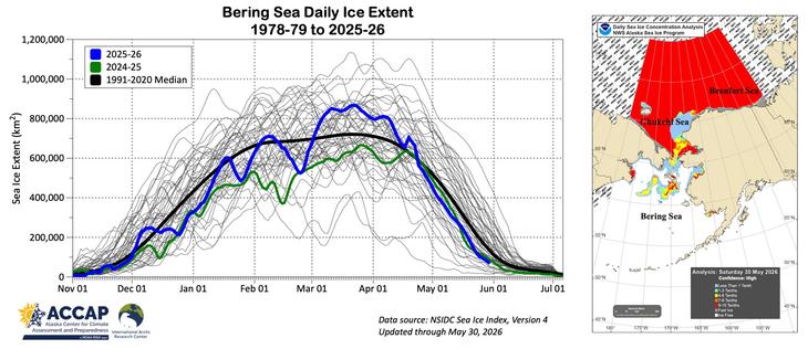
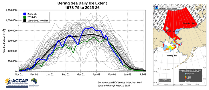
Sea ice is on the way out for the season in the Bering Sea. Increasing areas of moderate concentration ice in the southern Chukchi and large area open water persisting west of the North Slope coast: overall sea ice extent in the Chukchi Sea the lowest for May 30 since 2022. @Climatologist49 @ZLabe

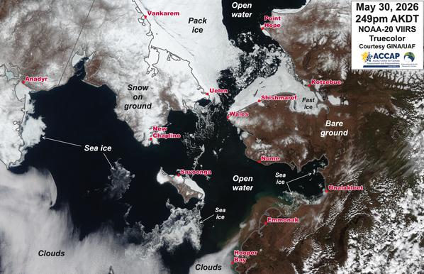
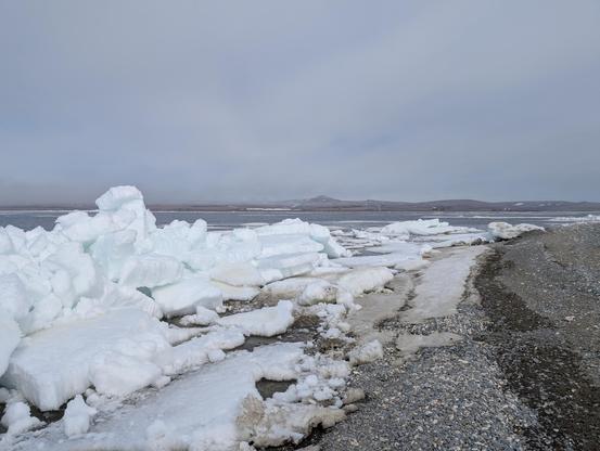
Spectacular clear sky satellite image Saturday afternoon of the greater Bering Strait region. Virtually the entire region was cloud-free, providing good look at the remaining sea ice and snow cover. Image courtesy GINA/UAF. @Climatologist49 @Jdnome

Sea ice in the Bering Sea well on the way to meltout. Still small areas of high concentration ice, especially from east of St. Lawrence Island northward through the Alaska side of the Bering Strait. Substantial area in Chukchi Sea west of the North Slope has opened up, and this is the most open water for the date in the Chukchi since 2020. @Climatologist49 @ZLabe