Urban Flood Observations [UFO] - A Hand-Labeled Training And Validation Dataset Of Post-Flood Inundation
--
https://doi.org/10.48550/arXiv.2604.23066 <-- shared paper
--
https://zenodo.org/records/19698577 <-- shared dataset
--
H/T
@Rohit Mukherjee
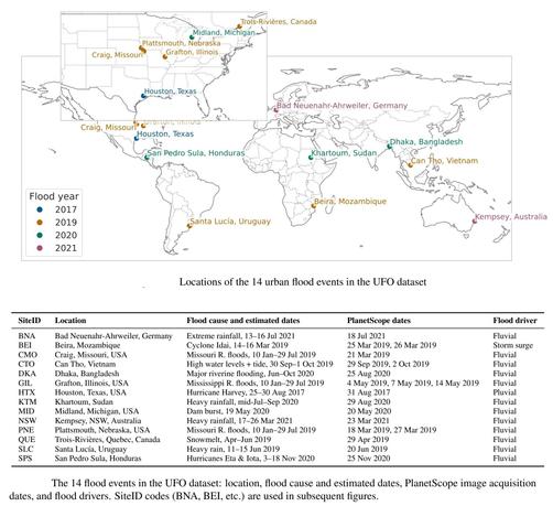
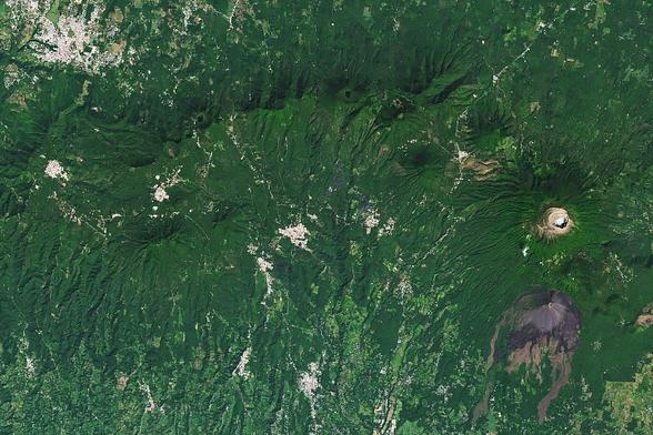
“UFO includes 215 high-resolution PlanetScope image chips and corresponding labels from 14 global flood events, with a focus on urban environments. The labels capture visible surface water in post-flood scenes.
Labeling floods from space is hard, especially in urban areas. Building shadows, narrow channels, wet soil, complex drainage features, and mixed pixels all make it difficult. [They] spent a lot of time refining the labels, and [they] think they can be useful for benchmarking flood-mapping methods and for training flood models (if you have PlanetScope access).
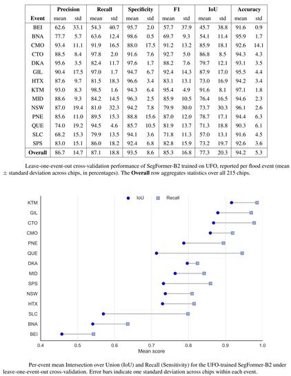
As an initial benchmark, [they have] trained a SegFormer model on the dataset and achieved a mean IoU of 77.3% under leave-one-event-out validation, where each flood event was held out entirely from training…”
--
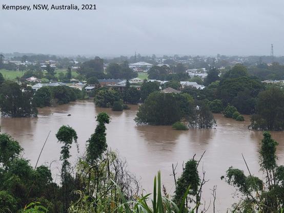
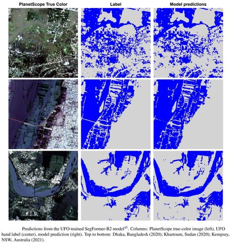
“Urban flooding affects lives and infrastructure worldwide. Mapping inundation in complex urban environments from satellite imagery remains challenging due to limited spatial resolution, infrequent acquisitions, and cloud cover. [They] present Urban Flood Observations (UFO), a global, hand-labeled dataset of post-flood inundation in diverse urban settings. UFO comprises 215 image chips (1024 by 1024 pixels) from 14 flood events between 2017 and 2021, derived from 3 metre PlanetScope imagery. Each chip is annotated with two classes: 'inundated' (all visible surface water, including floodwater and pre-existing water bodies (permanent or seasonal)) and 'non-inundated'. To demonstrate the dataset's utility, [they have] trained a segmentation model using leave-one-event-out cross-validation, achieving a mean Intersection over Union (IoU) of 77.3. [They] also used UFO to evaluate two widely used surface water products, the Sentinel-1-based NASA IMPACT model and Google's 10 m Dynamic World water class, which yielded IoUs of 44.1 and 48.1, respectively. UFO is publicly available to support the development and validation of urban inundation mapping methods…”
#UrbanFloodObservations #Urban #Flood #Observations #flooding #UFO #PlanetScope #remotesensing #GIS #spatial #mapping #opensource #opendata #floodmapping #model #modeling #floodmodels #infrastructure #water #hydrology #extremeweather #hydrography #humanimpacts #cost #economics #risk #hazard #segmentationmodel #elevation #topography #surfacewater #satellite #senteniel #IMPACT #testcases