The new bike lanes on 4th Avenue are now open, providing a protected bike route directly from the downtown core to the Space Needle. Though the bike lanes on Broad Street are also open, they currently dead end at 5th Avenue while crews work on the very cool Thomas Street plaza. The plaza should be open before the World Cup next month, so the wait shouldn’t be long.
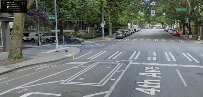
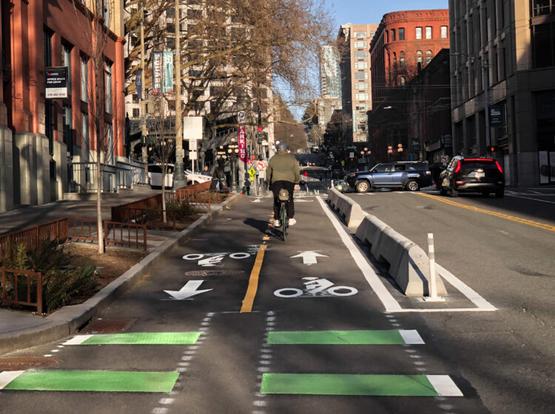
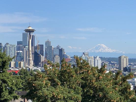
The bike lanes used to end at Vine Street. From Google Street View.I headed down for a rainy tour of the new lanes Friday, and it is just so nice that the 4th Ave bike lanes finally connect to Seattle Center. For years they have ended abruptly in the middle of Belltown, leaving people to fend for themselves in four lanes of mixed traffic. It was not a good situation, especially since biking to Seattle Center is one of those journeys that will attract lots of tourists and first time riders who are giving downtown biking a try during a major event. Now the ride to the Space Needle driveway is seamless, easy and comfortable.
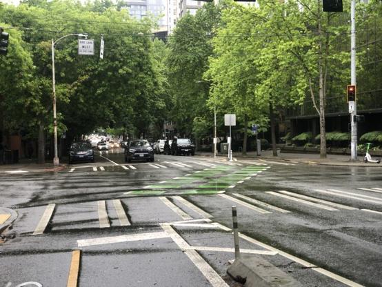
4th Ave also feels significantly calmer now that the extra lanes have been removed. The previous design had a ridiculous four-lane design more appropriate for a highway than a dense neighborhood like Belltown. People driving would then need to merge from four lanes down to two since nearly all traffic either goes straight or turns left at Denny Way (most people turning right on Denny will use an earlier street). The new design maintains two lanes the whole way, which is much simpler and should be safer for all road users, especially people using the now-shorter crosswalks.
The diagonal bike lane crossing from the west side of 4th to the east is still a bit unfortunate, but it seemed to work during my brief observation Friday. I only saw it on a rainy midday, though, so the real test will be when larger numbers use it for a major event, a sunny weekend or even just a busy rush hour commute. I also wonder how many people will continue straight through the green light as they have been doing for years.
The crossing at Denny was smooth and stress-free, which is not something you can say often when crossing that street. We’ll need to wait to see how it works when traffic is heavier, however.
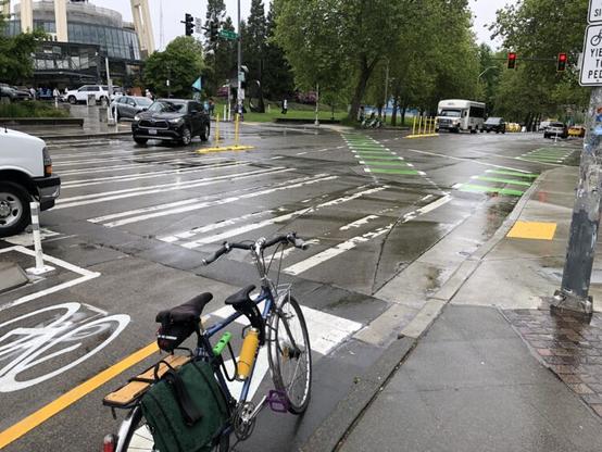
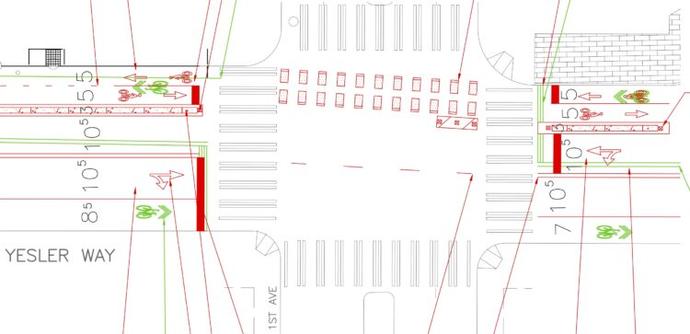
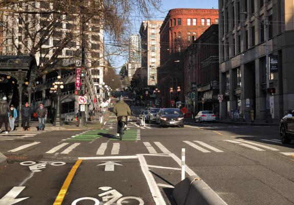
Looking toward the Space Needle from 4th Ave.The intersection of 4th/Broad/John/Space Needle Drive is by far the most complicated part of the whole project. Heading north, the bike lane curves right and continues on the south side of Broad Street to connect with Thomas Street once that plaza project is complete. However, most people heading to Seattle Center will likely want to navigate toward the Space Needle Loop. “[Bikes] Use Ped Signal” signs are intended to inform people that they should wait until the all-way walk phase, then cross diagonally toward the Space Needle to enter Seattle Center. The basic idea here is sound, giving people a car-free phase to enter Seattle Center. However, SDOT designers are going to need to pay close attention to how people behave in real life. A bicycle signal would have been a big help here. I know what to do because I have covered this project and understand the design, but I will be interested to see if the general public figures it out. The confusing part is that when the light is green for Broad Street, it really feels like people in the bike lane should go because green means go and there is no red bicycle signal to say otherwise. Maybe it will work fine, but I can’t really think of another intersection like this one so I don’t know for sure what to expect.
The Thomas Street plaza is nearing the end of construction but it currently closed completely.On Broad, the bike lanes should work fine, though I still think two-way bike lanes on the park side would have been preferable. It’s funny that the first person I saw using the lanes as I arrived was a person biking the wrong way in the park-side bike lane. There’s just such a strong natural desire to be on the park side of the street and to make connections into the park, I suspect there will be lots of wrong-way biking here. The good news is that the bike lane is quite wide. Until the Thomas Street plaza opens, the eastbound bike lane on Broad is a little awkward to use, but that’s a short-lived problem.
Looking west on Broad Street at 4th/John/Space Needle Loop.The westbound lane on Broad is designed assuming people are trying to get to 4th Avenue, and I found that connection to work well. People continuing straight on Broad toward the Sculpture Park and the waterfront bike lanes/Elliott Bay Trail need to merge into the single general traffic lane while crossing the intersection, though if they do this during the green bike signal phase then there should not be any cars to deal with. Seattle really needs to connect the disparate pieces of bike infrastructure on Broad Street, which is not in a good state today despite the impending opening of the new Myrtle Edwards Park and the recent opening of the Alaskan Way bikeway. A full Broad Street project should be a high priority for SDOT so that bike lane connections can be designed into the upcoming Elliott/Western paving project. It probably makes sense to time these two projects together due to all the overlap between them.
Go check it out and let us know in the comments how it worked for you.
#SEAbikes #Seattle