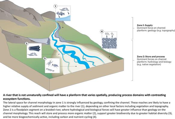
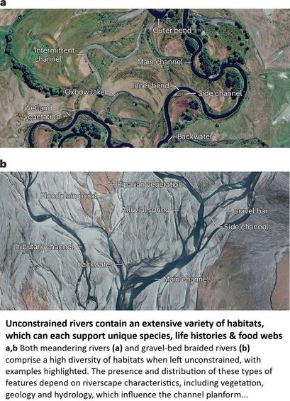
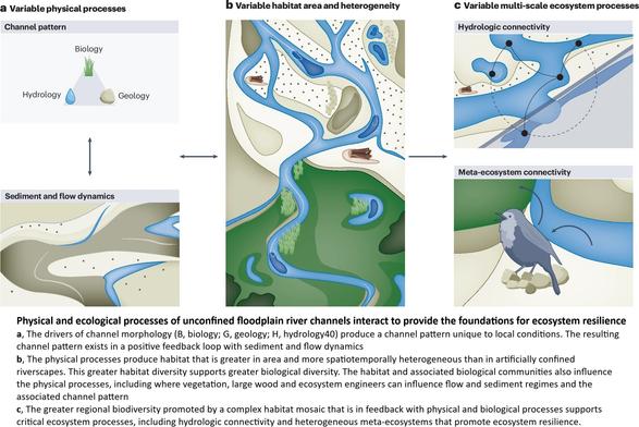
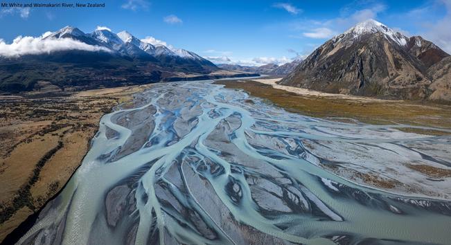
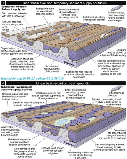
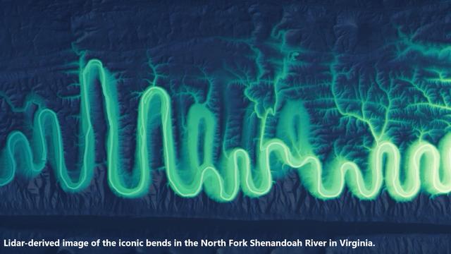
Human Disturbances Dominated The Unprecedentedly High Frequency Of Yellow River Flood Over The Last Millennium
--
https://doi.org/10.1126/sciadv.adf8576 <-- shared paper
--
https://www.smithsonianmag.com/smart-news/3000-years-humans-alterations-chinas-yellow-river-created-catastrophic-situation-exists-today-180951815/ <-- shared technical article
--
#humanimpacts #anthropogenic #water #hydrography #hydrology #flood #flooding #river #catchment #engineering #riverine #YellowRiver #China #climatechange #extremeweather #floodhazard #risk #hazard #history #historic #sediment #reconstruction #spatialanalysis #spatiotemporal #levee #breaches #Holocene #geologic #fluvial #sustainability #planning #management #watermanagement #stress #change #dating #radiocarbon #OSL #sampling #paleoflood #overtopping #slackwater #sedimentation #model #modeling #embankment #riverstage #dams
--
https://doi.org/10.1126/sciadv.adf8576 <-- shared paper
--
https://www.smithsonianmag.com/smart-news/3000-years-humans-alterations-chinas-yellow-river-created-catastrophic-situation-exists-today-180951815/ <-- shared technical article
--
#humanimpacts #anthropogenic #water #hydrography #hydrology #flood #flooding #river #catchment #engineering #riverine #YellowRiver #China #climatechange #extremeweather #floodhazard #risk #hazard #history #historic #sediment #reconstruction #spatialanalysis #spatiotemporal #levee #breaches #Holocene #geologic #fluvial #sustainability #planning #management #watermanagement #stress #change #dating #radiocarbon #OSL #sampling #paleoflood #overtopping #slackwater #sedimentation #model #modeling #embankment #riverstage #dams