GeoServer 3 is scheduled for General Availability on 15 April 2026.

A major step forward with Spring 7, JDK 17, ImageN raster performance, refreshed UX, and easier cloud-native deployment, while preserving 2.x compatibility.

Congrats to the GeoServer community and supporters.

#GeoServer #OpenSourceGIS #Geospatial #GeoIntelligence

FOSS4G 2025 Auckland recap: QField is production infrastructure now.

The pattern across deployments: QGIS Desktop → QField (offline) → QFieldCloud → Enterprise APIs

Not "can this work?" anymore. It's "how do we optimize this workflow?"

#FOSS4G2025 #QField #OpenSourceGIS

https://buff.ly/Laf6wAt

Where2B – Die Open-Source-GIS-Konferenz

Universitätsclub Bonn, Donnerstag, 18. Dezember um 09:15 MEZ

Where2B – Die Bühne für Open-Source-GIS.

Die Where2B ist der Treffpunkt für Entscheider, GIS-Profis und Innovatoren aus Wirtschaft, öffentlicher Hand und Wissenschaft. Wenn Sie Ihre GIS- und Digitalisierungsprojekte voranbringen wollen, sind Sie hier genau richtig.

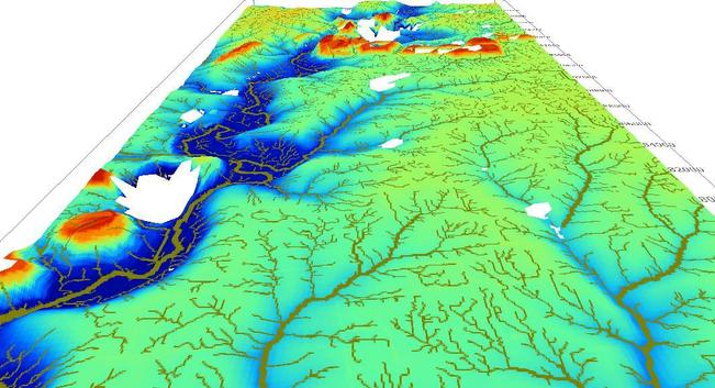
Tauchen Sie ein in ein vielfältiges und hochkarätiges Programm mit Praxisbeispielen zu QGIS, Digitalen Zwillingen (im Web), Glasfasernetzen, dem Wechsel zu QGIS und weiteren spannenden Anwendungsfällen. Profitieren Sie vom Austausch mit Expertinnen und Anwenderinnen, knüpfen Sie wertvolle Kontakte und gewinnen Sie Einblicke, die Sie direkt in Ihre Projekte übertragen können.

Verpassen Sie nicht die Gelegenheit, wertvolles Know-how aus der Praxis rund um Geo-IT mit Open Source mitzunehmen und Ihr Wissen auf das nächste Level zu bringen!

Publikum

Mehr als 500 Teilnehmende aus dem öffentlichen Bereich, der Wissenschaft und der Wirtschaft.

Vorträge

Topaktuelle Themen und neueste Entwicklungen - mit dabei interessante Praxisbeispiele aus unterschiedlichen Branchen.

Networking

Eine spannende Networking-Konferenz mit vielen Möglichkeiten des Wissensaustausches mit anderen GIS-Spezialisten.

Programm

Unter: https://where2b-conference.com/vortragsprogramm/

Wie kann ich mich anmelden?

Sie können Sich unter: https://where2b-conference.com/anmeldung/ anmelden. Im Anmeldeformular können Sie auswählen, ob Sie vor-Ort oder online teilnehmen möchten.

Vorort findet die Veranstaltung im Universitätsclub Bonn in der Konviktstraße 9, 53113 Bonn statt.

Die Anmeldedaten zur Onlinekonferenz werden ca. eine Woche vor Veranstaltungsbeginn per E-Mail zugesandt.

Die Teilnahme an der Where2B Konferenz ist kostenlos.

Quelle: https://where2b-conference.com

https://bonn.jetzt/event/where2b-die-open-source-gis-konferenz

🌳 The Greenness of Calgary — Community-Level Atlas Project

Over the past year, I’ve been working on a long-term project that maps and analyzes vegetation greenness across all Calgary communities using Sentinel-2 satellite data (10 m resolution).

Each atlas page shows detailed NDVI-based land-cover statistics and community-level summaries.
The results highlight both environmental gradients and the impact of local watering restrictions, weather patterns, and land-use intensity.

Two visual editions are available:
🌿 Green Edition – calm, analytical colors for research and reports:
🔗 https://datastory.gumroad.com/l/meqquj
🎨 Contrast Edition – high-contrast design for presentations and outreach:
🔗 https://datastory.gumroad.com/l/kqfmvnc

All maps and data were produced with R + QGIS + open satellite sources.

#RemoteSensing #GIS #NDVI #UrbanEcology #Calgary #DataVisualization #OpenSourceGIS #Cartography #yyc #GreennessOfCalgary #Alberta #Canada

Over the past few days, I’ve been refining a detailed hydrological model for the Inhulets River basin (Ukraine).

The goal is to reconstruct real surface-flow connectivity in a region with both natural and technogenic relief — open-pit mines, tailings ponds, subsidence zones, and artificial drainage structures.

The work is part of a larger multi-year study on the geochemical and hydrological evolution of the Kryvyi Rih Iron Ore Basin.

(attached: 3D terrain visualization)

#Hydrology #Geomorphometry #opensourcegis #InhuletsRiver #SagaGis

We're thrilled to finally reveal our logo FOSS4G Asia 2026! The open-source geospatial world is coming together in the historic city of Nashik, India, from 21-25 January 2026. Our logo, built from data-centric hexagons, represents the powerful community collaboration that defines FOSS4G. Registration now - start planning your journey to India's wine capital!

Website Link: https://foss4g.asia/2026/
#FOSS4GAsia2026 #OpenSourceGIS #Geospatial #Nashik #TechConference #OSGeo

My first time at the @osgeouk #foss4guk2025 conference in #Leeds this week. I really recommend anyone attending the next one.
It inspired me to highlight how #opendata #sentinel1 satellite imagery is a valuable resource for #environmental monitoring.
I applied this resource to #peatland using #qgis & was published in the @mdpiopenaccess Remote Sensing journal https://www.mdpi.com/2072-4292/17/16/2752
With zero funding resources, all of this was possible because of #opendata & #opensourcegis.
#earthobservation
🎉 Goed nieuws uit de #QGIS-gemeenschap! @GroeneBij Jeroen Hovens, penningmeester van #QGISNL, is verkozen tot Additional Financial Controller van QGIS.org tijdens de AGM. Zijn verkiezing onderstreept de actieve rol van NL in de internationale open source #GIS-wereld. #OpenSourceGIS #OSGeoNL

Want to start a QGIS User Group or grow one? Join us this Friday for a #QGISOpenDay session with @qgis PSC Chair @mbernasocchi & @timlinux! Learn how to launch, run, and connect your group globally 🌍

📅 26 Sept 2025
🕚 11H00 UTC
📺 Livestream and more info: https://github.com/qgis/QGIS/wiki/QOD-September-2025

Let's add more  User Groups to the map!

#QGIS #OpenSourceGIS #CommunityBuilding #QGISOpenDay

🎉 Exciting news! GISWorld is now an official Media Partner for FOSS4G Asia 2026 – the premier open-source geospatial event in Asia! 🌏

GISWorld delivers expert insights on QGIS, QField, CesiumJS, PostGIS & more, empowering the global GIS community. Stay tuned for tutorials, event previews & live coverage showcasing cutting-edge geospatial innovation.

#FOSS4GAsia2026 #GISWorld #OpenSourceGIS