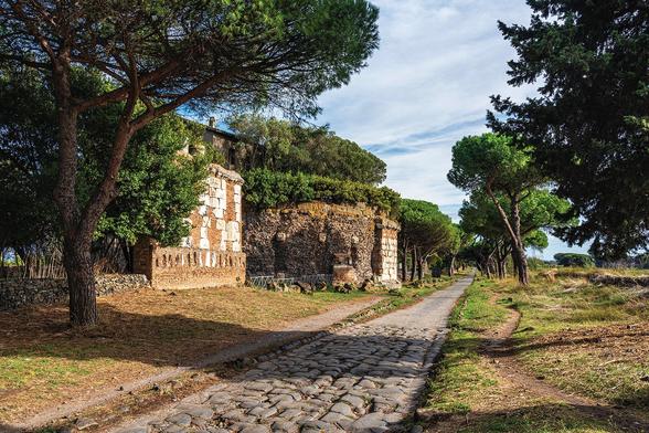
Fly around the world (Experimental)  |  Google Earth  |  Google for Developers

Google for Developers
New high‑resolution map transforms what we know about Roman roads and the Roman Empire

A massive digitization project has nearly doubled the known extent of the first continent-scale road network

Scientific American
Latest Hindi News : UP-यूपी में डिजिटल मैपिंग के लिए अगले साल से शुरू होगा ड्रोन सर्वे

उत्तर प्रदेश के नगरीय निकाय क्षेत्रों की भूमि के सटीक और डिजिटल नक्शे (Digital Map) तैयार करने के लिए अगले साल से ड्रोन सर्वेक्षण शुरू होगा।

Hindi Vaartha
The Spilhaus Projection-A World Map according to Fish — Southern Woodenboat Sailing

When Mr Lewin began explaining how cartographers addressed the challenge of portraying what is essentially a three dimensional object - the world - on a two dimensional plane - a piece of paper - my eyes lit up!

Southern Woodenboat Sailing
Latest #USGS Map-Product Release - 250K Topo OnDemand Topo Products Now Available Through The Topobuilder Application
--
https://www.usgs.gov/programs/national-geospatial-program/news/regional-view-reliable-data-introducing-usgs-250k-topo <-- USGS product announcement page and topoBuilder custom map construction application access
--
“The U.S. Geological Survey (USGS) has launched the 250K Topo, a new digital map product designed to support regional planning, land and resource management, and emergency response coordination…”
--
#GIS #spatial #mapping #USGS #OnDemandTopo #NGP #topoBuilder #OnDemand #250KTopo #Geospatial #TopographicMaps #GIS #MappingInnovation #OpenData #Maps #NGTOC #NGP #custom #opendata #latest #spatialdata #topomap #fedservice #fedscience #publicgood
@USGS