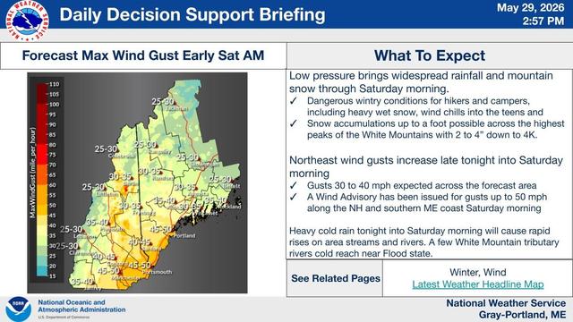
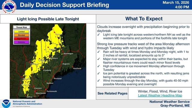
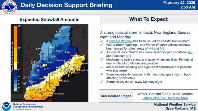
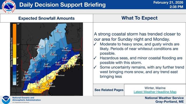
NWS Gray Emergency Managers Self-brief for Friday PM: Late season Nor'easter brings wind gusts up to 50 MPH, 6-9 ft surf, and snow at higher elevations. Hikers in high elevations should be aware of and prepared for winter conditions; coastal interests should be alert for dangerous swimming conditions from high surf. High Surf ADVISORY 8 AM - 8 PM saturday: https://forecast.weather.gov/wwamap/wwatxtget.php?cwa=GYX&wwa=high%20surf%20advisory #MEwx #NHwx #MEweather