
A joyplot view of Ireland’s population density #ireland #IrelandMap #100daysofmaps #day40 Map for UK and Ireland. #ggplot2 #rstats code here https://gist.github.com/halhen/659780120accd82e043986c8b57deae0


Places in Ireland with and without a pub. Map by Antonia Blankenberg
#ireland #IrelandMap #100daysofmaps #day39
#ireland #IrelandMap #100daysofmaps #day39

Population map of the North of Ireland, issued by the North Eastern Boundary Bureau 1923 #day38 #ireland #IrelandMap #100daysofmaps #ulster https://collections.lib.uwm.edu/digital/collection/agdm/id/22670/


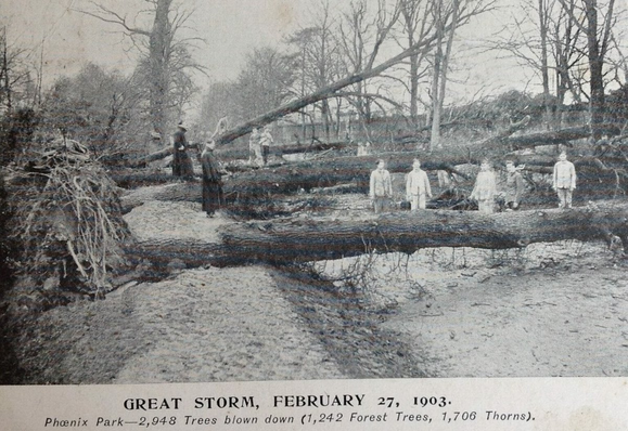
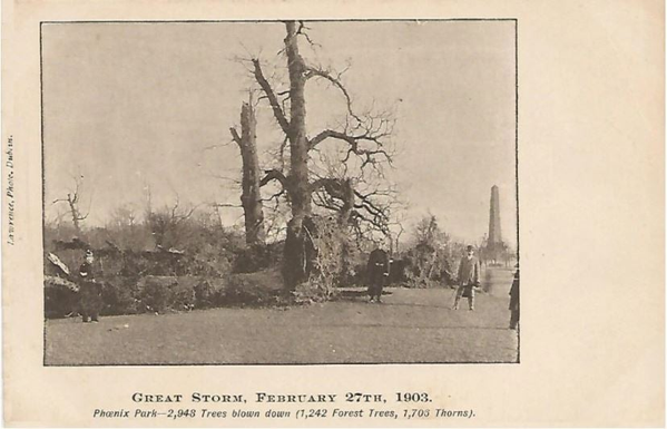
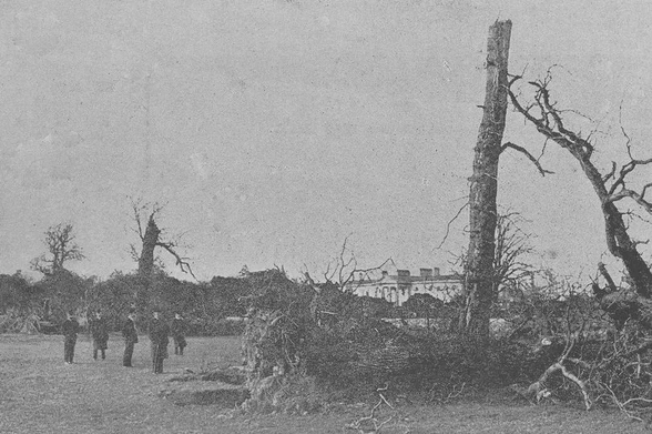
The map today is the strongest storm ever recorded in Ireland and how it only got recently recorded. The 1903 Ulysses storm. Phoenix park after the storm. The obelisk and Aras in the background
#ireland #IrelandMap #100daysofmaps #day36
#ireland #IrelandMap #100daysofmaps #day36
Ireland map of locations predicted to be under 2050 annual flood level
#ireland #IrelandMap #100daysofmaps #day35 #climatechange #flooding map is here https://coastal.climatecentral.org/map/10/-7.4482/54.7137/?theme=sea_level_rise&map_type=year&basemap=roadmap&contiguous=true&elevation_model=best_available&forecast_year=2050&pathway=ssp3rcp70&percentile=p50&refresh=true&return_level=return_level_1&rl_model=gtsr&slr_model=ipcc_2021_med
#ireland #IrelandMap #100daysofmaps #day35 #climatechange #flooding map is here https://coastal.climatecentral.org/map/10/-7.4482/54.7137/?theme=sea_level_rise&map_type=year&basemap=roadmap&contiguous=true&elevation_model=best_available&forecast_year=2050&pathway=ssp3rcp70&percentile=p50&refresh=true&return_level=return_level_1&rl_model=gtsr&slr_model=ipcc_2021_med


Map of traditional butter churn types around Ireland. From Irish Folk Ways #ireland #IrelandMap #100daysofmaps #day33

The spatial distribution of pet dogs and pet cats on the island of Ireland
by Downes et al #ireland #IrelandMap #100daysofmaps #day32 dogs blue cats yellow
by Downes et al #ireland #IrelandMap #100daysofmaps #day32 dogs blue cats yellow

