Building a Procedural Hex Map with Wave Function Collapse
https://felixturner.github.io/hex-map-wfc/article/
#HackerNews #Building #Procedural #Maps #WaveFunctionCollapse #HexMap #GameDev
Building a Procedural Hex Map with Wave Function Collapse
https://felixturner.github.io/hex-map-wfc/article/
#HackerNews #Building #Procedural #Maps #WaveFunctionCollapse #HexMap #GameDev
I've been using Obsidian for my notes for a while. I just published my first addon! Since I've been writing a novel for a while, I needed a quick and easy world editor in Obsidian. And well... there wasn't one that met my requirements. So I developed one myself and would like to share it with you. It's free, but I'd be happy if you "bought me a coffee". :)
Until it's officially in the app, here's my release:
https://github.com/Taroslord/Hex-Cartographer

Hex Cartographer is a hex map editor for Obsidian. Design fantasy worlds with lovingly crafted symbols, terrain types, rivers, paths & borders. Add text annotations & print, or export the r...
Another one of those individual scale / company scale battle maps.
Noteworthy here is the permanent Mist covering the area centred around the huge dead tree - the home of Fallen Nymph (Mist Nymph), who has transformed from a nature spirit into a twisted Mist entity.
Bore da! I see that the Welsh Senedd has got new constituencies for the 2026 elections; 16 in total, each electing 6 Members. So our old Senedd hex cartogram is out-of-date.
I've created a new hex layout at https://open-innovations.org/projects/hexmaps/editor/?../maps/wales-senedd-constituencies-2026.hexjson It's hard to keep a good shape/neighbours with only 16 hexes.
Are you based in Wales? If so, could you have a look and see what could be improved? (That link doesn't magically save anything so manually save any edits you make).
Schon vier Monate her, aber bisher an mir vorbei gegangen.
Andreas Åkre Solberg hat eine innovative Hexmap der deutschen Landkreise erstellt. Anders als herkömmliche Karten stellt sie jeden Landkreis gleich groß als Hexagon dar –ideal für Analysen, bei denen jeder Landkreis gleich bedeutend ist. #DataViz #Hexmap #GIS

Da die Wahlen in Deutschland näher rücken und weil Deutschland wahrscheinlich die beste Fachgemeinschaft für Datenvisualisierung hat, habe ich versucht, eine ähnliche Hexmap für die deutschen Kreise zu erstellen, wie ich es gerade für die norwegischen Kommunen getan habe. Ich hoffe, dass es für einige nützlich sein kann. #Datenvisualisierung #DataViz #Geodaten #GIS #Wahlen #Hexmap #Deutschland #Kartografie #Datenanalyse #OpenData #Innovation
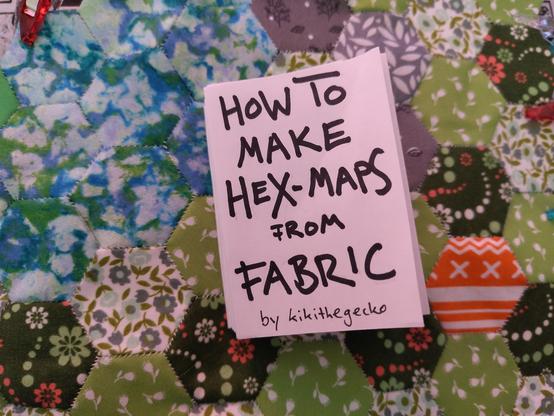
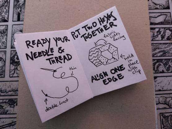
Hello, I made a lil zine!
Edit: And I just published it on itch: https://kikithegecko.itch.io/how-to-make-hex-maps-from-fabric
Feel free to send me a DM if you want one (or more) printed and assembled copies in exchange for shipping costs (I am located in Germany) + pay what you want.