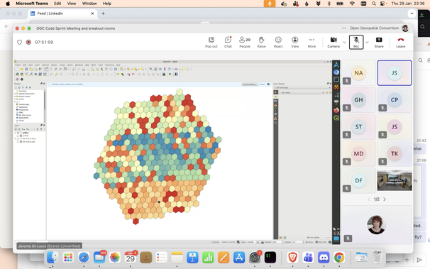
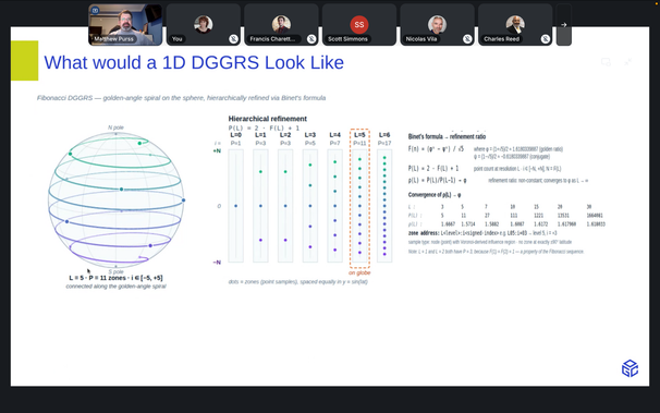
Matt Purss describes what a 1D DGGRS would like (following the Fibonacci sequence) at the #OGC API SWG meeting in Helsinki #DGGS #OGCAPI
Los DGGS y su importancia en el gobierno del dato
DGGS son las siglas de Discrete Global Grid System (Sistema de Rejilla Global Discreta). En este artículo se explica qué es exactamente un DGGS, por qué sus propiedades son relevantes para el dato, y cómo ciertas iniciativas están demostrando su valor.
DGGS en la práctica: quién los está usando
Aunque los DGGS pueden parecer un estándar reciente, varias organizaciones llevan años usando estos sistemas en producción con resultados muy concretos. Algunos ejemplos ilustrativos:
Uber con H3. H3 nació dentro de Uber para resolver un problema muy concreto: calcular precios dinámicos y casar oferta y demanda en cada ciudad. La compañía agrupa los millones de eventos diarios (viajes, peticiones, posiciones de conductores) en celdas hexagonales y, sobre esa rejilla, calcula tarifas, predice demanda y optimiza despachos. La librería es de código abierto desde 2018 y se ha convertido en estándar de facto en muchos sectores.
...
La buena noticia es que el ecosistema está madurando rápido: el estándar abstracto está consolidado, hay una API oficial, existen implementaciones abiertas —H3, S2, DGGAL, rHEALPix— y los pilotos como AI-DGGS demuestran que la pieza encaja con las arquitecturas modernas de datos e IA. La conversación, simplemente, ha empezado, y a las oficinas de gobierno del dato les corresponde liderarla en sus organizaciones.
#DGGS #DiscreteGlobalGridSystem #SistemaDeRejillaGlobalDiscreta #SectorPúblico #DatosAbiertos

Here is a bit of a preview on where things are with the #GeoPlegma project. More soon to come.
https://www.linkedin.com/posts/joaocsmanuel_dggs-geoplegma-deckgl-ugcPost-7463623488235372545-NAIp
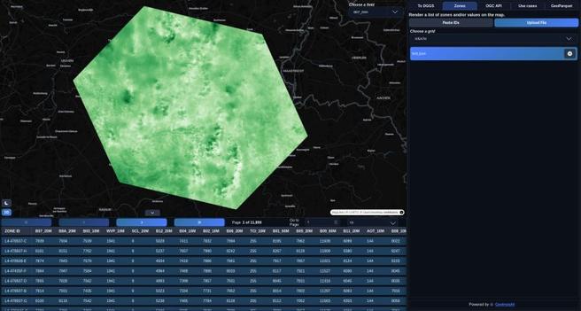
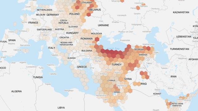
At GeoInsight, we’ve been building dggs.io for a while now, continuously improving it as this demo product evolves. For those unfamiliar: dggs.io is a website for exploring and visualizing DGGS (Discrete Global Grid System) data, making spatial indexing systems easier to inspect, experiment with, and work with visually. A lot of DGGS tooling assumes your data is already tied to a specific rendering stack or grid implementation. That makes data exploration harder than it should be. I also wanted to visually test the work we have been doing at GeoPlegma (https://lnkd.in/eTdKBAAs). So I added a new capability (in dggs.io/zones) You can now visualize data directly from DGGS zone IDs by: • Uploading JSON files (specific format, check the paste section) • Loading Parquet datasets • Reading Zarr data (although this only requires a parent ID, and the depth of the refinement level) • Pasting zone IDs directly (specific format) You only need your IDs and it's associated data. I use deck.gl to visualize on the map. This works across multiple DGGS grids, deck.gl native ones (H3, A5, QUADKEY, S2, GEOHASH) and including systems outside deck.gl’s native support, with interoperability across ecosystems like and Geoplegma-compatible grids (IVEA7H, ISEA3H, etc, which are coming from DGGAL). The goal is simple: Reduce the friction between having DGGS-indexed data and actually exploring it visually. No custom preprocessing pipeline. No assumptions about a single grid ecosystem. No injected geometries, you just load zone IDs with your integrated data, and inspect the data. This is the kind of the product problem I enjoy solving. The screenshots are from the Sentinel-2 bands integrated into a DGGS grid from a json file, and the other one is a DEM from Canada, from a parquet one. These files were generated by our API. If you notice something is off or a bug with the website, please let me know privately, and if you also want I can provide examples. Also, if you work with DGGS or spatial indexing systems, I’d love to hear what tooling gaps still slow you down. Special thanks to Michael Jendryke, Dr. #dggs #geoplegma #deckgl #geoinsight
a5R brings the A5 pentagonal geospatial index to R.
Equal-area pentagonal cells across 31 resolutions, encoded as 64-bit integers, with millimetre-level precision at the finest scale 🗺️
R package by Hugh Graham; a5 by Felix Palmer


Darafei Praliaskouski, member of the #PostGIS PSC, walks through an interesting hands-on case study of modelling #LoRa radio tower range in the mountains of Georgia using #H3 and PostGIS. The example covers data preparation, #DGGS indexing, and spatial analysis, and offers some food for thought.
Darafei Praliaskouski, member of the #PostGIS PSC, walks through an interesting hands-on case study of modelling #LoRa radio tower range in the mountains of Georgia using #H3 and PostGIS. The example covers data preparation, #DGGS indexing, and spatial analysis, and offers some food for thought.

The #OGC ran an #AI-#DGGS pilot on disaster management and derived five pillars for geospatial AI readiness from it: tool-ability, machine-readable metadata, guardrails, reproducibility, and trust & security. Among the interesting follow-up work items: enabling non-DGGS clients, treating the time dimension as a first-class topic alongside space, and cataloging which spatial analysis functions should be available in a standardized #DGGS-based manner.